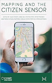
Mapping and the Citizen Sensor
Overview & Synopsis
Maps are a fundamental resource in a diverse array of applications ranging from everyday activities, such as route planning through the legal demarcation of space to scientific studies, such as those seeking to understand biodiversity and inform the design of nature reserves for species conservation. For a map to have value, it should provide an accurate and timely representation of the phenomenon depicted and this can be a challenge in a dynamic world.
Indexed from repository: FreeComputerBooks.com
(
freecomputerbooks.com)
Keyboard Shortcuts:
← / → for pages • + / - for zoom • 0 to fit width
Powered by Mozilla PDF.js v3.11
Document Information
| Document Title | Mapping and the Citizen Sensor |
|---|---|
| Author / Organization | Giles Foody (Editor), Linda See (Editor), Steffen Fritz (Editor) |
| Subject & Discipline | Geographic Information System (GIS) and Web Mapping, Computer Graphics, 3D, Animation and Imaging, Data Analysis and Data Mining, Big Data, Statistics and SAS Programming |
| Categories | Geographic Information System (GIS) and Web Mapping |
| Publication Year | 2017 |
| ISBN | 1911529161 |
| License / Rights | CC BY-NC-SA 4.0 |
| Resource Verification | Access Restricted / Protected Host |
| Alternative Mirrors & Links | |
| Original Host Website |
FreeComputerBooks.com
(freecomputerbooks.com)
|
| File Format | application/pdf (Portable Document Format) |
| Language | ENGLISH |
| Catalog ID | DOC-269751 |
| Original Source Link | Visit Source Page on freecomputerbooks.com » |
Commercial / Print Edition
Prefer a Physical Book or Kindle Edition?
Mapping and the Citizen Sensor • Print Edition
As an Amazon Associate, MainReads earns from qualifying purchases.