Geographic Information Science (GIS)
Reference documents in Geographic Information Science (GIS).
Documents in Geographic Information Science (GIS)
Page 1 of 1-
Depicting the world, territory, and geopolitical realities involves a high degree of interpretation and imagination. It is never neutral. Cartography originated in ancient times to represent the world and to enable circulation, communication, and economic exchange. Today, IT companies are a driving force in this field and change our view of the world; how we communicate, navigate, and consume globally.
-
This book focuses on medium-sized cities and more specifically on their open spaces from psychological, sociological, and aesthetic points of view. The book will be of interest to readers in architecture, urban planning, and landscape architecture.
-
Time Geography is a mode of thinking that helps in the understanding of change in society, the wider context and ecological consequences of human actions. This book presents its assumptions, concepts and methods, and example applications.
-
The development of Historical Geographical Information Systems (HGIS) and other methods from the digital humanities have revolutionised historical research on cultural landscapes. The aim is to advance cartographic practices.
-
Rare earths are neither rare nor technically earths, but they are still widely believed to be both. Although the approach focuses on the human, or cultural, geography of rare earths mining, it could be both on Earth and on the moon.
-
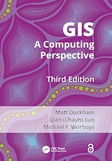
Analyzing the subject from a computing perspective, this book provides a full, up-to-date overview of Geographic Information Science (GIS), both Geographic Information Systems and the study of Geographic Information Science.